In rural land security, local government departments often provide low-resolution and imprecise local image maps that are unsuitable for use as a base map for field operations. To address this issue, low-altitude aerial photography using **UAVs** has become the most effective solution. Surveying and mapping **drones** can capture full coverage aerial images with a resolution of 0.05 meters, allowing for the selection of ground control points to perform orthorectification. This process significantly improves the geometric accuracy, enhances image interpretability, and ensures high precision and accurate positioning, resulting in an orthographic image at a scale of 1:1000.
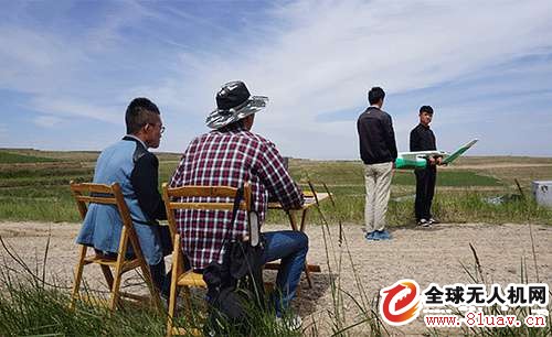
A typical surveying and mapping drone team consists of 2–3 members. After completing the aerial photography mission, the collected data is reviewed and tested before proceeding with further processing. To provide a more realistic and hands-on experience, we traveled to Lanzhou, Gansu, to document the operation of the P700E UAV in the field. We also detailed the entire process of using mapping drones in rural land confirmation, hoping to offer practical insights and support for your work and studies.
1. **Determine Weather Conditions**
Before starting any flight, it's crucial to check the weather conditions. The thickness of clouds, lighting, and air visibility must be carefully observed to ensure safe and effective aerial photography.
*Observe the thickness of the cloud*
2. **Arrive at the Takeoff Location**
Once the weather is confirmed, the team brings the drones, catapults, radio stations, computers, and other necessary equipment to the designated takeoff point. The location is usually pre-inspected to ensure it is flat, free of wires or tall buildings, and the flight order is planned in advance.
3. **Determine the Wind Speed at the Scene**
Upon arrival, the wind speed is measured. The P700E mapping UAV can operate in winds up to 6 on the Beaufort scale and functions well in temperatures ranging from -20°C to 60°C.
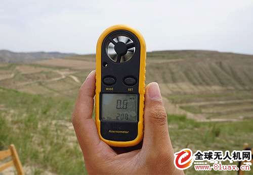
*Measuring site wind speed*
4. **Set Up the Catapult**
To ensure smooth takeoff, the catapult is typically set up against the wind. The P700E features an integrated ejection frame that requires minimal space and adapts well to various terrains. Its projectile rope design is more convenient and faster than other systems, ensuring operator safety.
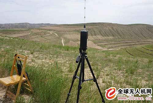
5. **Set Up the Radio Station**
The radio station facilitates communication between the ground control station and the drone. The high-frequency radio of the P700E allows for ultra-long-distance monitoring up to 50 kilometers, ensuring the safe and efficient operation of the aircraft.
6. **Daily Job Log**
It’s important to record key information such as wind speed, weather conditions, takeoff and landing coordinates, and other relevant data. This log serves as a reference for future analysis and data validation.
7. **Attitude Angle Adjustment**
For flights that start more than 200 km away from the previous takeoff point, the drone’s attitude and angle need to be adjusted to ensure accurate communication. The P700E is equipped with an electronic compass and magnetic calibration tools to maintain stable self-attitude control during flight. Its built-in calibration system helps manage varying geomagnetic conditions, reducing human interference and potential safety risks.
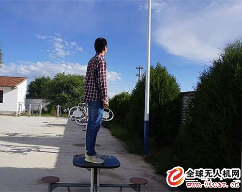
8. **Place the Drone on the Catapult**
Before launch, the drone’s components should be checked to ensure they are securely connected, and the power supply for the catapult is properly wired and fully charged.
Relay Control Voltage Regulator
PC-TM series Relay Control Voltage Stabilizer has the low energy consumption,the over voltage protection,the low voltage protection,the over-current protection,the over-loading protection,the over-temperature protection and so on.It boasts for many kinds of protections,the collection energy conservation and the environmental protection ect.This is a brand-new concept product which possess many new technologies!This series products simultaneously ha applied for many technical monopolies
We already applied many kinds of this products patent, and the technical patent NO: 200720036394.1 and Appearance paten NO: 200730025909.3
2. Use for equipment:
Computer
Test equipment
Light system
Safe alarm system
Ray equipment
Medical equipment
Copy machine
Stereo equipment
Numerical control machine tools
Industrial automation equipment
Color and drying equipment
Test equipment
Hi-Fi equipment


Relay Control Voltage Regulator ,Voltage Regulator For Ac,3000Va Voltage Regulator,Wall Mount Voltage Stabilzier
zhejiang ttn electric co.,ltd , https://www.ttnpower.com