Cadillac draws high-precision maps to make self-driving taxis

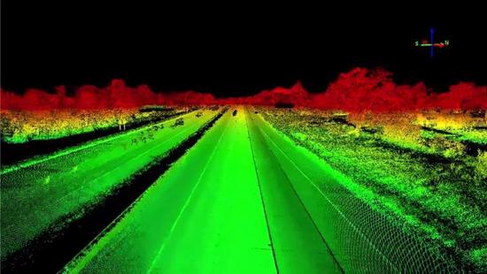
On October 13, Netease Smart News reported that Cadillac has taken a bold step in the development of autonomous driving technology by integrating laser radar systems into its vehicles. Rather than just adding sensors to the car, the automaker is using lidar technology to create detailed maps of U.S. and Canadian highways. This data is then used to enhance the Super Cruise semi-autonomous feature, allowing the car to navigate with greater precision. This approach marks an important milestone in the journey toward full autonomy.
Full self-driving capability still relies on several key factors: government regulations, sensor advancements, high-performance computing, and accurate mapping. Safety remains a top priority for vehicle laws, and there's a growing need for consistent federal guidelines rather than varying state-level rules. As these technologies evolve, the path to fully autonomous vehicles becomes clearer.
As sensor costs decrease and their accuracy improves, the ability to process large volumes of data also increases. High-definition maps are essential for reliable navigation, whether on city streets or rural roads. Cadillac is leading the charge by being one of the first automakers to implement lidar-based mapping, but this trend is likely to spread quickly across the industry.
Many modern cars with semi-autonomous features rely on detailed maps to maintain their route. For example, Tesla uses crowd-sourced data, while Mercedes-Benz integrates Here Maps to help determine appropriate speeds during turns. These maps are highly detailed and serve as the backbone for advanced driver-assistance systems (ADAS).
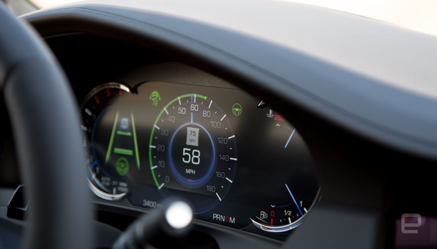
Cadillac’s Super Cruise system, which uses lidar maps, stores data in the trunk of the CT6 model. The system has an error margin of less than 10 cm and can scan up to 2,500 meters ahead of the car. This allows the onboard computer to analyze road conditions and decide whether to continue using the semi-autonomous feature or prompt the driver to take control.
When companies like Uber and Lyft deploy self-driving taxis or autonomous bus fleets, they will need similar local map storage solutions to ensure safe navigation in complex urban environments. These maps must be updated frequently—sometimes daily, hourly, or even every few seconds—to prevent service disruptions caused by network outages.
Even with all the data and sensors in place, self-driving taxis will still face challenges on the road. These vehicles typically follow pre-determined routes to minimize risks. They may deviate slightly to pick up passengers, but if a ride is requested outside the mapped area, users might have to walk a short distance to reach a self-driving car.
At the chip level, the technology for autonomous vehicles is already well-developed. NVIDIA recently launched the Drive PX Pegasus, the world’s first AI-powered driving platform, aimed at accelerating the arrival of Level 5 self-driving cars. According to Danny Shapiro, NVIDIA’s senior director of automotive, these vehicles will also generate and update maps while driving—a crucial part of the future of autonomous mobility.
In the coming years, thanks to innovations like Cadillac’s lidar technology, cars will become smarter through continuous learning. Sensors will collect more data, and powerful computers will process it in real time. The detail in these maps will grow exponentially, and as more manufacturers adopt this approach, vehicles will make better decisions based on real-world experiences and simulations.
For now, Cadillac’s CT6 with lidar technology is helping bring autonomous vehicles to all types of roads, not just highways. However, in the early stages, you might still need to walk a few blocks to find an autonomous taxi.
(Source: Engadget, compiled by Netease Smart News. Robot Review by Rain Egg.)
Follow the Netease Smart Public Account (smartman163) for the latest updates on artificial intelligence and smart tech trends.
Shenzhen Kaixuanye Technology Co., Ltd. , https://www.icoilne.com